
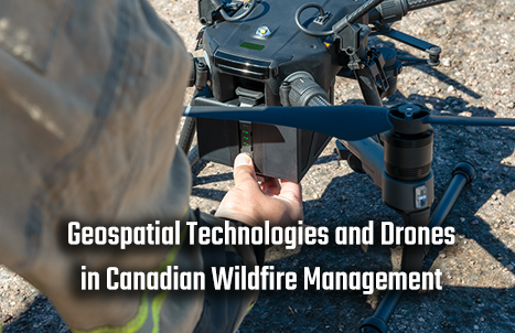

Geospatial Technologies and Drones in Canadian Wildfire Management
Introduction
2023 marked the most severe wildfire year in history, underscoring the crucial need for more effective and efficient wildfire control and extinguishment. Some regions in Canada frequently experience dry and hot summers, creating favorable conditions for wildfires. Particularly in western provinces and territories, the months from May to September bring high temperatures and low humidity, leading to excessively dry vegetation that is highly susceptible to ignition.
The vast forest cover and vegetation types in Canada contribute to the frequent occurrence of wildfires. Extensive coniferous forests and dry shrubbery form inflammable vegetation, and once a fire breaks out, it tends to rapidly spread. This was evident in the wildfires of 2023, which persisted from March to November. The intricate interplay of natural and human factors makes it immensely challenging to control and extinguish fires, resulting in society grappling with substantial casualties and financial losses. Hence, the development of geospatial technologies and drone capabilities emerges as the paramount technological approach to wildfire control.

Source: https://enterprise.dji.com/public-safety/firefighting
Geospatial Technology’s Role in Wildfire Management
The widespread application of Geospatial technology has provided unprecedented tools and resources for disaster management. The use of Geographic Information Systems (GIS), coupled with high-resolution satellite imagery and geographical data, empowers disaster management teams to gain comprehensive, real-time insights into the development of wildfires as soon as they occur.
How Drones Are Changing the Way We Fight Wildfires | Mashable. (YouTube)
This aids in making timely decisions and allocating resources more efficiently. Various types of drones provide diverse data for different directions of geospatial analysis, including the spread direction and severity of the fire, forest distribution, wind speed and direction, current temperature, humidity, and other environmental factors.
How Drones are Being Used by First Responders to Save More Lives. (YouTube)
By continuously monitoring factors such as the location of the fire, its spread, and the condition of vegetation, these technologies generate a wealth of data, enabling emergency teams to more precisely devise firefighting plans. GIS technology can also integrate historical wildfire data, which, through specific data analyses, assists in predicting areas that may be affected by current wildfires in the future, allowing firefighting departments to prepare in advance.
Real-time Monitoring and Fire Assessment with UAV Technology
Surveillance drones equipped with high-resolution thermal imaging cameras and sensors can monitor the heat intensity and spread of wildfires in real-time. These data provide emergency teams with detailed assessments and generate high-definition heat maps, capable of tracking individual trajectories, fire propagation, and changes in intensity. Combined with natural environmental factors such as wind speed, direction, temperature, and humidity, this information aids rescue teams in formulating more effective firefighting strategies and evacuation plans.
Drones vs. California’s wildfires: How they’re helping firefighters. (YouTube)
The agility of small, heat-resistant, and robust drones allows them to navigate through complex terrains, providing comprehensive wildfire data. They can access hard-to-reach areas before firefighters enter the scene, capturing crucial information like vegetation density, topography, and wind direction. This offers emergency responders a more comprehensive perspective, enhancing efficiency while ensuring the safety of firefighting personnel.
The Role of Drones in Firefighting
The role of medium to large drones in firefighting extends beyond the use of high-definition cameras, sensors, and GPS systems. These drones can also carry firefighting materials for extensive aerial deployment over the fire zone. Similar to their applications in agriculture, where large drones are employed for widespread pesticide dispersal, these drones can be equipped with firefighting agents such as water or flame retardants. They can precisely release these firefighting agents from the air, covering large areas affected by wildfires.
A Unique Approach: DJI Mavic 3 Thermal, Firefighters, and Rescue Dogs. (YouTube)
This method can rapidly extinguish the source of the fire or impede its spread. Equipped with advanced navigation and sensing technologies, drones ensure the accurate delivery of firefighting agents, maximizing firefighting effectiveness and minimizing agent wastage.
Drones in Post-fire Assessment and Environmental Monitoring
After the extinguishment of a fire, the temperature in the affected area remains exceptionally high, posing significant dangers to rescue personnel. Drones provide panoramic and thermal images, offering intuitive data support for post-fire assessment. These images can be used to determine the extent of environmental and financial damages, identify hotspots, and pinpoint potential areas of re-ignition. By monitoring environmental impacts such as smoke distribution and water source contamination, drones supply timely information to aid environmental protection efforts. If there are still injured individuals or animals in the fire zone, rescue operations can be continued.
The data collected through environmental monitoring not only contributes to understanding the ecological impact of the fire but also guides ecological restoration plans. Equipped with various sensors, drones can additionally monitor air quality and soil changes, providing scientists with comprehensive environmental data for subsequent analysis.
Conclusion
Geospatial technology and drones have played a crucial role in Canadian wildfire management. With continuous advancements and developments in technology, they will become more comprehensive and detailed. In the future, facing severe natural disasters, the application of geospatial technology may even lead to fully mechanized rescue and firefighting efforts.
References:
https://www.jouav.com/blog/drones-in-firefighting.html
https://www.intechopen.com/chapters/1153997
https://www.intechopen.com/online-first/88205
https://enterprise-insights.dji.com/blog/drones-in-forest-fire-response
https://www.youtube.com/watch?v=z1RK8vaivfQ
https://drdrone.ca/blogs/drone-news-drone-help-blog/how-drones-are-saving-lives
https://www.dslrpros.com/firefighting-drones.html
https://www.youtube.com/watch?v=TfBWRb-kYy4
https://www.flytbase.com/blog/drone-fire-fighting
