Emmanuel Stefanakis

Head of Department for University of Calgary Geomatics Engineering Program in Alberta, Canada.

Articles by Emmanuel Stefanakis

Geomatics Engineering at UCalgary: Join a global leading program in education and research

Introduction Housed within the Schulich School of Engineering at the University of Calgary, the Department of Geomatics Engineering is one…

GeoPackage: A format with database capabilities

A couple of months ago the Open Geospatial Consortium (OGC) sought public comment [1] on the new version of GeoPackage…

Graph Databases – Recent development in Neo4j may help accommodate the Geospatial Community

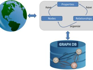
Graph Databases and GIS & Technology (GIS&T) In the era of big data, graph databases are becoming very popular as…

Geospatial Development: Enhancing GIS curricula with programming skills at UNB

Geospatial information science and technology (GIS&T) has rapidly evolved over the last few decades. This evolution has created a highly…

SaveTheMap Campaign: What is the future of geospatial information in India

SaveTheMap Campaign: “to encourage citizens and startups to use geospatial data in everyday lives and create businesses that serve India”…

NetCDF: a growing standard for encoding georeferenced data in binary form

Recently, the Open Geospatial Consortium (OGC) has announced an extension to the OGC CF-netCDF 3.0 encoding standard that specifies how…

Location Encoding Systems – Could geographic coordinates be replaced and at what cost?

Geocoding is the process of converting a street address into a physical location that can be described with a pair…

Discrete Global Grid Systems – A new OGC standard emerges.

The beginning of 2016 was accompanied with a sonorous press release from the Open Geospatial Consortium (OGC) entitled: “OGC® seeks…

Map Tiles and Cached Map Services

  The tiling of large maps is an old practice. Large paper maps have always been divided into a series…

Elevation Web Services: Limitations and Prospects

Elevation Web Services: Limitations and Prospects Elevation data is necessary for a wide range of geospatial applications such as creating…

Web Mercator: the de facto standard, the controversy, and the opportunity

Four hundred and fifty years ago, the Flemish geographer and cartographer Gerardus Mercator presented the most popular map projection ever.…

2005-2015: Ten Years with Google Maps

In February 2005, Google Maps was launched as a desktop web mapping service. A few months later, in June 2005,…