At first glance, navigating the world has never been easier. Getting from Point A to Point B is a snap; just pop an address into your Global Positioning System (GPS) or pull up a map on your smartphone or computer, and you’ll get directions to precisely where you want to go. No need to find a paper map, orient yourself on it or figure out how far and in what direction you need to go. Just follow the line on the screen or page, and you’ll get there — it seems so simple and effortless.

The only problem is, it isn’t simple, and it often requires an enormous amount of effort. As people become more and more reliant on technology to do their wayfinding for them, they are losing their basic geographic literacy — their capacity to take in geographic information, critically analyze it and make decisions.
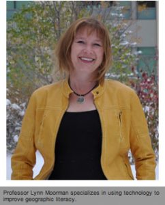
For Lynn Moorman, an assistant professor of Earth Science and General Education at Mount Royal, giving students the tools to understand geography and to use that information to formulate complex ideas has become her career’s focus – and has made her a significant contributor to the cause of “geo-literacy” across Canada.
Taking the path of an educator
Moorman’s focus on geo-literacy combines her interest in both education and geography, and includes perspectives into the field’s pedagogy, cognitive science, educational technology, digital geography and spatial thinking.
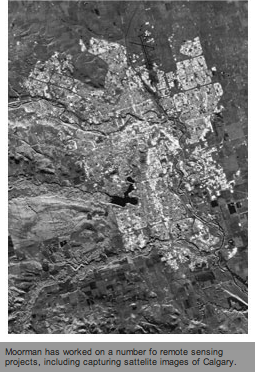
Moorman studied physical geography and spatial analysis in her undergraduate and master’s degrees. Her interest in Geographic Information Systems (GIS) and remote sensing — remotely collecting information from the earth like infrared and microwave energy via sensors on satellites and airplanes — led to participation in a number of exciting initiatives, including working with the Canadian Space Agency and living in North Vietnam, assisting with the mapping of the country’s farthest-flung regions.
Ultimately, her interest in helping people understand geographic information led her to return to Canada to develop new ways of teaching geography. In 1995 and 1996, she helped create Earth Observation, a course on interpreting geographic data that was integrated into Ontario’s grade nine curriculum. Once the program was developed, she was responsible for teaching it to teachers, an experience that changed her career and led her to join Mount Royal in 2010 as a professor.

Taking technology to teaching
Moorman’s background in the technology that underpins modern geography has made her an ideal candidate to educate students about the present and future of understanding the world geographically. Moorman is continuing her education, pursing a PhD in Educational Technologies at the University of British Columbia, Okanagan. Moorman’s PhD research has been funded by Social Science and Humanities Research Council (SSHRC), The Killam Trusts, and Canadian Institute for Geomatics, University of Calgary and University of British Columbia.
“I know the technology side and I have an intuition about teaching, but taking that next step and working on my PhD in Education Technologies with a focus on geographic technologies has helped put it all together,” says Moorman. “My research has recently looked at the role of virtual globes like Google Earth in providing context for grade five and six STEM (science, technology, engineering and math) education.
“Watching these students grow to understand and interpret the world around them using these technologies and watching that impact in other aspects of their education has been fascinating.”
Moorman is looking to help foster that understanding even further, working on a proposal to develop GIS-like software targeted for grades K-6 for the popular SMART boards developed in Calgary.
A fine Fellow
Moorman’s commitment to geo-literacy doesn’t stop with her research and teaching. She has also been a Fellow of the Royal Canadian Geographic Society since 2011, an Honorary Killam Scholar and is the Faculties of Education Representative for the Canadian Council for Geographic Education.
Her ongoing commitment to geographic education and supporting technology has been noticed, with a recent feature in Canadian Geographic magazine that highlights her strategy to not only enhance geographic education but to build Canadians’ capacity to think and reason geographically, making informed decisions about the environment, resources and populace.
 “The biggest issue we face as educators is geographic awareness, getting people to look at problems with a geographic lens,” said Moorman. “While technologies are putting geographic information into our hands, these new maps are not static or permanent and need to be considered with a critical eye. We need to ask questions about all of this data we are getting before we use it — where is it coming from, how accurate is it, who owns it, and how do we use it most effectively?
“If I know all the letters of the alphabet, am I literate? It isn’t until I put those letters in words, put them in a sequence make sense and use those words to express my view of the world that I can truly be considered literate. The same goes for geographic literacy; knowing a location is just the beginning, making informed decisions based on geographic data is the end. You have to start with the building blocks and work up to the fully articulated finished product.”
Taking geo-literacy to the next level
Fresh from her feature in Canadian Geographic, Moorman is off to Ottawa to attend the annual Royal Canadian Geographic Society College of Fellows Dinner in Ottawa. The dinner is part of a weeklong trip where she will meet her peers in the geographic community from all over Canada to work on the next steps for her geo-literacy project. She continues to focus on the latest tools and options available to teach geo-literacy in Canada. For Moorman, the same tools that have made maps an intrinsic part of our lives have created fundamental challenges.
“Mobile devices like smartphones and GPS are beneficial as they allow us to find something, but we also need to find out about the things that surround it and how they are connected. Some populations have become so reliant on GPS they are losing the ability to read a normal map. We can also use GIS as a great tool for critical thinking and project-based learning in the classroom, but there are obstacles like cost and resourcing that we need to concentrate on, as well as ensuring students just aren’t pushing buttons but are thoughtfully using the technology. I have every hope that we’ll be able to overcome these challenges and help keep Canadians literate in a geographic sense.”
— Colin Brandt, Oct. 25, 2012
Please find the original publication here courtesy of Mount Royal University


Be the first to comment