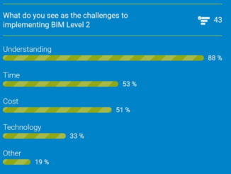
Between the Poles – The Geoff Zeiss Archives
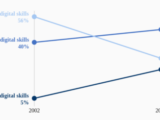
Increasing proportion of U.S. jobs require digital skills
In a new report from the Brookings Institution Digitalization and the American workforce the changing requirements for digital skills for job types covering 90% of the U.S. workforce has found dramatic changes in the last 15 […]