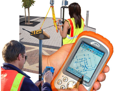
When Jon Murphy asked me to write something about ‘Surveying and CAD’ this month I thought, “no problem, when do you need it?” Upon more reflection, it occurred to me that I should write about trends – and try to bring an international perspective into the Canadian mix. After all, there are several companies and organizations in Canada, that participate not only nationally, but on a global scale.
To write about surveying and CAD means writing about a host of related technologies though. Data wants to be visible. Data wants to collaborate. Data wants to add value. And the reality is: projects involve more people today than before.
Surveying and CAD are rapidly changing today. These changes are being driven by Canadians wanting-needing to participate in a national and global marketplace as well as the global market for surveying and CAD extending into Canada too. The trend is toward collaboration and sharing, and cloud-based systems are augmenting that approach.
Surveyors are finding that field technologies increasingly link to office systems through Internet connections. Higher automation in surveying related technologies is leaning towards increased real-time presence. Examples of this can be found in GPS-based monitoring of infrastructure where constant measurement is providing data to signal and warn of failure, potential disaster and other implications for buildings, bridges, dams and other structures. High resolution surveying can be found in the building of railways in Canada and the measurement of railbed operations throughout the country.
On the leading edges, survey related technologies are now veering into the building information modeling (BIM) areas. Although debate about BIM continues, a constant throughout these projects is the development of a digital model. These models include 2D, 3D and 4D data types. Value is added to such projects through the inclusion of high quality data that increases usability, re-purposing, higher collaboration and by saving time based on a shared model approach that avoids having to re-invent the wheel time and time again.
If you look closely at surveying technology manufacturers today, you will find that they are moving quickly into the building and design realm. In some cases they are acquiring construction and infrastructure related companies, and in other cases they are forging new friendships and partnerships. This is resulting in tighter links between CAD and surveying, where the word ‘design’ is becoming part of the surveying vocabulary more prominently and design professionals are becoming increasingly aware, through the shared model approach, that the kinds of data surveying technology deliver can have design implications.
Surveying is about much more than land survey alone. From an international perspective, we can see surveyors involved in questions related to climate change, social factors, energy use and so on. The underlying principle behind these efforts lies in the importance of understanding administrative systems based on land ownership, project development, demographics, energy use and other factors. Measurement is the foundation for this understanding, and the need for better quality data. People are an integral piece of the surveying – CAD equation today, but geographic information systems (GIS) are also.
There are several surveying technologies that harness survey field data, bringing it directly into CAD and GIS. From there a wider number of people can use the surveyors output, delivering service and products to a wide multi-disciplinary chain. Architects, land administrators, urban planners, spatial designers, owners and operators etc. can all access what they need through this kind of approach.
For too long the spatial information community has been hung up on issues relating to whether or not a CAD or GIS is more accurate – which misses the point, since a GIS and CAD can both represent field data of the same quality. The key issue has always been about the data itself, how accurate and precise it is. Secondly, another issue has been related to who and how people can access these data.
Server technology and cloud-based technologies that extend to include Android, Apple, Windows and Linux are linking the field and non-professionals into the measurement and design chain. Alas, contrary to surveyors, CAD and GIS professionals thinking they will become redundant, the truth is far from it. More than ever these groups need to leverage these technologies against discipline based experience and knowledge. Cloud technologies are stirring past approaches toward new opportunities.
For surveying and CAD individuals and organizations, the international market can influence what happens in Canada in profound ways. Accordingly, it also means that these professionals need to collaborate and come up with a strategy that not only ‘does surveying and CAD’ but one that includes an understanding of other spatial technologies and how they all combine to provide needed measurements, need spatial analysis and needed consumer products that support the chances of projects succeeding, obtaining funds and being approved.
Such an appreciation is not only beneficial locally and nationally in Canada, but could enable greater export of Canadian geomatic talent, knowledge and experience to major projects around the globe.
Check out other Canadian surveying and CAD articles here: Surveying and CAD in Canada


Be the first to comment