
This time around GoGeomatics Canada is looking to the west to find Hydrologist Timothy Ensom at Golder Associates. Welcome to GoGeomatics Canada Tim. Thanks for taking the time to talk to us.
GoGeomatics: First off Tim can you tell about where you are from and how you decided on a career in, hydrology, geocryology, and GIS analysis?
Tim: I’m from Ottawa, and grew up in a family with a strong environmental conscience. High school elective courses in Environmental Science and Outdoor Education, which I took out of interest, helped me decide to attend Trent University for a B.Sc. in Environmental Science.
Trent University: After a fascinating first-year introductory course in Physical Geography, I selected courses for the remainder of my program to qualify for a joint major in Environmental Science and Physical Geography. Nearing the end of my program, I decided to stay for a fifth year to write an Honours thesis, under the supervision of Geography Department professor Jim Buttle, on the water balance of a series of Northern Ontario headwater lakes where I had conducted recent fieldwork.
Algonquin College: Having learned some introductory GIS while at Trent, I enrolled in Algonquin College’s GIS Graduate Certificate Program after completing my B.Sc. It was a comprehensive program, and provided me a skill set which complemented my degree very well. An occasional instructor in the GIS program – Suzanne Klassen of Golder Associates’ Ottawa office – was in contact with me following an application I’d made there. This led to an eight-month contract as a Geomatics Professional, where my primary responsibilities were the production of figures for reports and proposals for Ottawa geotechnical projects, and also the creation of a geodatabase providing engineers efficient access to half a decade of company geotechnical data for the region.
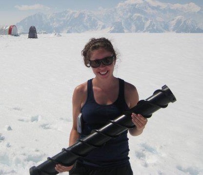
Carleton University: Following my positive undergraduate experience, I had been realizing that I wanted to continue in science. I was very fortunate to be living next door to Canadian climate scientist and IPCC Board member John Stone, who encouraged my growing interest in pursuing a Masters degree. Of the M.Sc. programs to which I applied, I chose to attend Carleton University on the basis of the response from and interest shown in me by Prof. Chris Burn. This was one of the best decisions of my life. Chris’ longtime research activities in the western Canadian Arctic, and connections with the northern research community, helped me to develop a fascinating and pertinent research project examining the thermal regime of Mackenzie Delta surface waters and their control on regional permafrost configuration. I conducted fieldwork over two summers, working in partnership with Steve Kokelj and the Water Resources Division of Aboriginal Affairs and Northern Development Canada as an NSERC Northern Research Intern. My focus on northern hydrology and permafrost expanded to include glaciology, as I was very fortunate to participate in the Canada-Norway Cryosphere Exchange (CryoEX) program, which took me to the University of Oslo and University Centre in Svalbard for courses in glacier dynamics and modelling.
About half a year after completing my M.Sc., a former colleague from Golder in Ottawa put me in contact with the Edmonton Golder office, which needed a hydrologist for work locally and in the NWT. I was offered a position there. Given the component of northern work, and the fact that I knew and liked the company, I decided to make the long move.
GoGeomatics: Tim your educational career path has been interesting. Can you tell us how you went from environmental science to GIS and then to an M.Sc. at Carleton. What drove you to do that?
Tim: I remember discovering, during my educational program in GIS and also during my subsequent work in that field, that I wanted to work more in the outdoors. It was that, in addition to the desire to get back into science, that led me towards an M.Sc.
GoGeomatics: You are in a unique position to explain the difference between a one year college technical diploma like Algonquin and a graduate degree like your masters. Can you compare and contrast the two programs? What are the strengths and weaknesses of each?
Tim: I feel that a technical diploma and graduate degree are intensive and extensive, respectively. The GIS certificate from Algonquin, which as a prerequisite required a degree in Geography or related discipline, really developed students’ technical skills upon a knowledge foundation we all held. The course boosted my marketability, in a wide range of sectors, by equipping me with skills in cartography, data management, programming, and spatial analysis. The learning outcomes were identified at the outset, as college programs often have a good idea of the specific needs in the related industry. From my employment searches, GIS appeared sometimes to be a job in itself, and at least as frequently to be an important component in occupations in the fields including engineering and science.
I feel that the main advantage of a graduate degree is that it provides experience in developing a process to answer a question or solve a problem. It is about creating new knowledge and sharing it. While a technical diploma such as GIS also emphasizes problem solving, such solutions are developed within systems that have already been engineered. In the case of the graduate degree (and in this case in natural science), the knowledge gained is about a system that exists in nature. It think that the advantages and disadvantages of each kind of program are determined by one’s interests.
GoGeomatics: What did you especially like about each type of education?
Tim: I liked the element of creativity in each type of program. It was very satisfying, while in my GIS Certificate program, to think about the specific skills I’d gained and how useful they could be in solving problems. In my Masters, I liked the field component and the people I met at all stages and places. They were curious, engaged, and fascinating. Of the two programs, it was the Masters that has really defined my professional interests.
GoGeomatics: Can you tell us a bit about your first geomatics job?
Tim: It was the ideal work opportunity to follow my GIS training, and I am very lucky to have had it. I was able to apply and expand my GIS skillset, while interacting with and learning from professionals in environmental science. This was important, because the context of GIS technical work makes it more interesting. I was part of an information management group, of about eight, whose roles ranged from CAD drafting to cartography to database creation and development. My main duty was the production of figures for projects and proposals using ArcGIS 9.2. There were good data resources available, and the standards for figure and cartographic products were clear, though open to improvement. There was also a good process for GIS product quality checking and assurance in place at Golder, as review is an integral component in the field of professional engineering. It was a consulting environment, of course, and provided me the opportunity to gain experience in time management, efficient and concise work, and communication. Colleagues, many of them professionals in the field of environmental science, provided very useful perspectives as I considered the type of focus for my upcoming M.Sc. program.
GoGeomatics: Can you tell us about your most challenging project there?
Tim: My most challenging project there was also very interesting. Golder had recently been joined by one of Ottawa’s longest-serving and most accomplished Geotechnical Engineers: Gordon McRostie. His projects, dating back to the late 1940s, contribute to a comprehensive geotechnical picture of much of Ottawa. The geotechnical borehole locations from those projects needed to be added to Golder’s geodatabase so that the geological attribute data, stored in the project reports, could be accessible for current projects. Figures and plans from projects completed decades ago needed to be properly georeferenced, using current Ottawa base data, in order to correctly place the borehole records. Solutions sometimes required the analysis of historical photos, former transportation routes, and other insightful forays into Ottawa’s history.
GoGeomatics: It would be fair to say that you have a passion for photography. Can you share a few of your favourite photos with the GoGeomatics community? Have you been able to link your photography to your geomatics skills or work in any way? (This question might need work I’m trying to make a link where their may be none)
Tim: It’s true, however I haven’t yet found an opportunity to combine my geomatics work with my photography. Click here to view a few of my favourite photos! There are descriptions with them. Most come from travel and fieldwork activities.
GoGeomatics: Can you tell us about your current position? Where is it? How did you land your current job?
Tim: I’m working as a hydrologist with Golder Associates in Edmonton. While I’m quite new to the position, my responsibilities centre around the delineation of watersheds and investigation of watercourse discharge and water quality parameters. There is both an engineering and aquatic science component to the work we do, and our group is a combination of these two disciplines. This came about when a former colleague of mine, from Golder’s Ottawa office, forwarded my resume to a company colleague in Edmonton. A phone interview resulted, and then, a few weeks later, a job offer. I also have my sister to thank for her networking, as that started the whole thing!
GoGeomatics: What types of projects are you working on now? Can you share any of your maps or analysis with us? (might be nice if you picked an interesting project and explained it, some maps would be cool)
Tim: Many of my projects have to do with locations where proposed transportation infrastructure would cross watercourses. In these situations, hydrologic and aquatic habitat assessments have to be done to determine what kind of permitting process must be followed. Often, a watercourse network layer and proposed pipeline (or other infrastructure) layer are combined in a GIS to determine a series of crossing locations. Watersheds corresponding to these points are delineated using ArcGIS toolbox features or through my analysis of the stream network and elevation data. From there, aquatic scientists and biologists determine habitat potential, and field investigations are scheduled to verify these conditions. I am fortunate to be a part of most of the steps in this process.
GoGeomatics: Are there any skills or courses you are planning on taking in the near future to augment your skill set?
Tim: Yes. I plan to continue with my registration as an Environmental Professional (EP) through the Environmental Careers Organization (ECO) Canada, and also as a Professional Geoscientist (P.Geo). ECO Canada is a very good source of information on employment opportunities, often in fields that require geomatics experience. So far in my new role I have taken courses on discharge measurement under ice (Canadian Water Resources Association), snowmobile operation (Portage College), and in several areas of occupational health and safety.
GoGeomatics: Thanks for taking the time to share your career experiences.
Tim: Thank you. If I can be of any help to anyone, by answering questions or suggesting contacts, I would be very happy to.


Be the first to comment