
Modern Canada is internationally renowned for its cartographic practices and strong mapping systems. Canada is host to vast landscapes and diverse in climates and topography. These lands and waters were mapped and surveyed, by many of the worlds great explorers. This article highlights five of those explorers who are considered to have made significant contributions to the field of mapping and surveying. These explorers are ranked by their contributions, beginning with the least recent expedition.
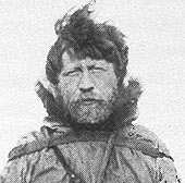
5. Vilhjalmur Stefansson
Our first great Canadian explorer to be highlighted is Vilhjalmur Stefansson (November 3rd ,1879 – August 26th ,1962). Stefansson was a Canadian explorer and anthropologist of Icelandic decent. He explored the Artic regions of Canada and Alaska between 1906 and 1918. Though Stefansson’s contribution to mapping and exploration in Canada have been the most recent, his research and exploration into the Artic are important. His published research into the arid arctic regions, resulted in the publication of more than four hundred articles and roughly twenty-five books. Stefansson is seen as a great producer of literature on exploration on subzero climates. Stefansson went on to be a major founder of Cold Regions Research and Engineering Laboratory at Dartmouth College, which specializes in scientific exploration and engineering into cold environments. This laboratory provides major support to the United States government and military. He is considered to be a “prophet of the north” and one of the world’s foremost Artic explorers.
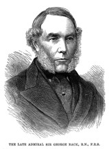
4. Sir George Back
Sir George Back (November 6th ,1796 to June 23rd ,1878) was an explorer, naturalist and artist, who migrated to Canada from England to explore the Artic in 1818. Back conducted a number of journeys, the most prominent of which is the Coppermine exploration. During this exploration Back surveyed and mapped the Coppermine River and northern coast of Canada. He also charted the Mackenzie River, 1824-1826. Back’s contribution to mapping in Canada came about after he led his own expedition in 1834 to survey and explore the entire length of the Great Fish River, which was later renamed to Back River. Back’s contributed to mapping and exploration in Canada through the publication of his charts, maps, and records collected while exploring. While exploring Canada, he used a camera lucida to sketch anything he came across, mostly forest fires, rapids, rock formations, campsites and native settlements. Through this exercise, he became one of the most sought after topographers of his time. This gained him knighthood and a medal from the Royal Geographical Society.
3. Simon Fraser
Simon Fraser (May 20th ,1776 to August 18th ,1862) was a fur trader and explorer of Scottish American decent. Fraser lived with his uncle in Montreal after his immediate family was forced to move from New York to St. Andrews West near Cornwall Ontario. After attending school for a short period of time, Fraser joined two of his cousins in the fur trade in 1792. He later became an apprentice clerk with the North West Company of Montreal, working his way up to partner in 1801. Fraser was selected to oversee the extension of the company’s activities to the area west of the Rocky Mountains. He explored the area and named it New Caledonia, which is now central British Columbia. He established strong trading relations with the aboriginal peoples. He later established Fort McLeod in 1805, Fort St. James and Fort Fraser in 1806, and Fort George in 1807. Fraser was asked to find a trade route to the pacific by the North West Company, as it was a company objective. He explored what he thought was the Columbia River’s outlet to the ocean, but that proved futile. Fraser’s exploration was successful after searching 520 miles in length and 36 days long where he discovered the mouth of the river at Musqueam. The area that Fraser explored was later named the Fraser River by fellow explorer David Thompson. Fraser’s exploration developed the fur trade industry through his establishment of various trading posts.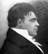
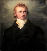
2. David Thompson
Another prominent example and probably the most well known explorer is David Thompson (April 30th , 1770 to February 10th , 1857). Thompson was a fur trader and surveyor by profession who contributed to mapping and exploration in Canada through charting of the entire Columbia basin. This exercise included exploration of the length of the Columbia River while charting the surrounding areas. Over the span of his career, he mapped more than one fifth of the entire North American continent. Thompson’s maps were highly accurate and precise, bringing him prestige and respect as a pioneer in the field of mapping. Thompson and his entourage established a number of trading posts in the Columbia basin on behalf of the Hudson Bay Company. He was one of the company’s principle surveyors and a renown fur trader.
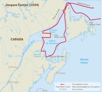
1. Jacques Cartier
The contribution of mariner and explorer Jacques Cartier (December 31st ,1491 to September 1st ,1557) illustrates that he was a great explorer. Cartier, journeyed to Canada on France’s behalf, with the objective of setting up a colony here. Twenty days after sailing westward from France, he sighted Newfoundland and Labrador. He then sailed southward into the Gulf of St. Lawrence. He also sighted New Brunswick and Prince Edward Island before sailing into the Bay of Chaleur. Cartier then sailed up the St. Lawrence River as far as the indigenous village of Stadacona (Modern Quebec City) before going onto what is now the greater Ottawa area. On his return trek, he claimed a hill that he named Mont Réal (Mount Royal), just behind the Hochelaga village in order to observe Ottawa and the Lachine rapids. This is Montréal today. Cartier also explored much of what is now the Cabot Strait before returning to France to prepare for a follow up voyage in 1541. After this voyage was unsuccessful in its attempt to establish a colony in northern Québec, Cartier published his accounts in 1545.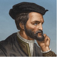
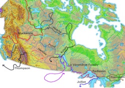
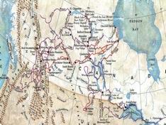
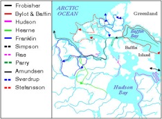
This map shows the voyages of other great explorers.


Be the first to comment